Bogor Trail Run
- Distance: 18.4 mi
- Elevation gain: 3,176 ft
- Maximum elevation: 1,791 ft
- Elevation loss: 3,199 ft
- Minimum elevation: 600 ft
- Moving time: 5 h 42 m
- Moving speed: 3.2 mph
- Maximum speed: 8.4 mph
- Total time: 6 h 23 m
- Global speed: 2.9 mph
- Date: 02/02/2024
Interactive map
GPS track profile
About this GPS track
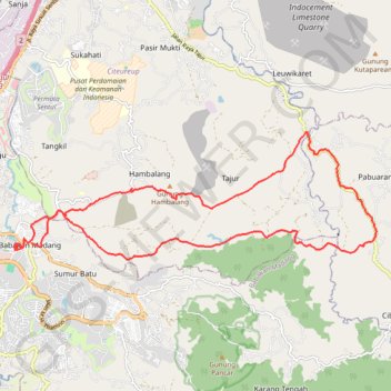
Name: Bogor Trail Run GPS track, route, trail
Coordinates: -6.56775 106.86032 -6.53608 106.95035
Topography: Bogor topographic map