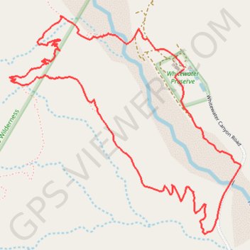
Whitewater Canyon Loop
Loop hike around the Whitewater River via the Pacific Crest Trail (PCT) and the Whitewater Canyon Road in the Sand to Snow National Monument. #Hike #Loop #Canyon #River #Mountain #Nature #PCT
- Distance: 3.7 mi
- Elevation gain: 817 ft
- Maximum elevation: 2,762 ft
- Elevation loss: 820 ft
- Minimum elevation: 2,087 ft
Interactive map
GPS track profile
About this GPS track
Name: Whitewater Canyon Loop GPS track, route, trail
Coordinates: 33.97987 -116.66780 33.99196 -116.65236
Topography: Riverside County topographic map