Import a GPX file

Staines to Richmond by bike

Bike between Staines and Richmond via Shortwood Common, Ashford, Hanworth Park, Crane Park, River Crane, Moormead Park and River Thames. #Bike #City #Nature #River #Forest

  • Distance: 13.6 mi
  • Elevation gain: 144 ft
  • Maximum elevation: 75 ft
  • Elevation loss: 161 ft
  • Minimum elevation: 23 ft

Interactive map

GPS track profile

About this GPS track
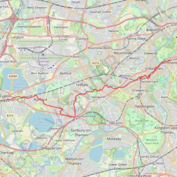
Other GPS tracks

Click on a GPS track to view route, its statistics and profile.

Tour de Londres

Royaume-Uni > Angleterre > Londres

Vélo. En boucle depuis Londres. #Vélo #Boucle

Distance: 46.4 mi • Elevation gain: 971 ft • Maximum elevation: 141 ft