Pipeline TGI by AGM
- Distance: 330.2 mi
- Elevation gain: 5,932 ft
- Maximum elevation: 318 ft
- Elevation loss: 5,984 ft
- Minimum elevation: 10 ft
Interactive map
GPS track profile
About this GPS track
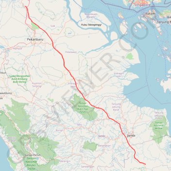
Name: Pipeline TGI by AGM GPS track, route, trail
Coordinates: -2.28830 101.23386 1.26122 103.93528
Topography: Tungkal Jaya topographic map
Other GPS tracks
Click on a GPS track to view route, its statistics and profile.
Kualanamu International Airport to Jakarta, Indonesia
Indonésie > Sumatra du Nord > Deli Serdang > Beringin
Distance: 1,124.2 mi • Elevation gain: 36,014 ft • Maximum elevation: 410 ft