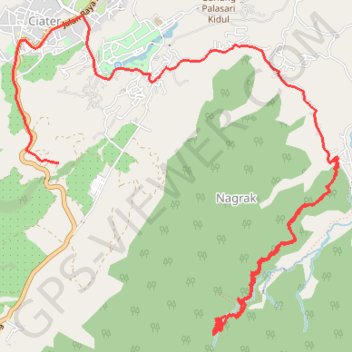
Randonnée cascade Ciater
Randonnée pédestre. #Randonnée
- Distance: 9.3 mi
- Elevation gain: 3,330 ft
- Maximum elevation: 3,773 ft
- Elevation loss: 4,426 ft
- Minimum elevation: 2,582 ft
Interactive map
GPS track profile
About this GPS track
Name: Randonnée cascade Ciater GPS track, route, trail
End: Nagrak, Kabupaten Subang, Java occidental, Jawa, 41281, Indonésie (-6.74728 107.67577)
Coordinates: -6.76387 107.64535 -6.73381 107.67612
Other GPS tracks
Click on a GPS track to view route, its statistics and profile.
Kawah Domas par les champs de thé
Indonésie > Java occidental > Kabupaten Subang > Ciater
Randonnée pédestre. En aller simple. #Randonnée
Distance: 4.7 mi • Elevation gain: 2,388 ft • Maximum elevation: 6,024 ft