Point Lobos Loop
Interactive map
GPS track profile
About this GPS track
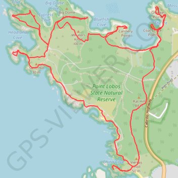
Name: Point Lobos Loop GPS track, route, trail
Coordinates: 36.50725 -121.95387 36.52290 -121.93576
Topography: Monterey County topographic map, elevation, terrain
Other GPS tracks
Click on a GPS track to view its route, statistics and profile.
Point Lobos Loop
United States > California > Monterey County
Point Lobos Natural Reserve offers an amazing blend of coastal beauty and wildlife, making it a perfect escape into nature. From serene coves to rocky shores, trails are well-maintained and easy to follow, with plenty of chances to spot sea otters, birds, and sea lions along the way. With sweeping Pacific…
Distance: 6.4 mi • Elevation gain: 676 ft • Maximum elevation: 108 ft