Hobart Mills - Overland trail - Exploration
Tahoe National Forest
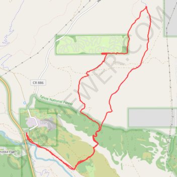
- Distance: 8.6 mi
- Elevation gain: 876 ft
- Maximum elevation: 6,378 ft
- Elevation loss: 883 ft
- Minimum elevation: 5,781 ft
Interactive map
GPS track profile
About this GPS track
Name: Hobart Mills - Overland trail - Exploration GPS track, route, trail
Start: Hobart Mills Road, Klondike Flat, Nevada County, California, United States (39.39836 -120.18702)
End: Hobart Mills Road, Klondike Flat, Nevada County, California, United States (39.39804 -120.18686)
Coordinates: 39.39091 -120.18702 39.42355 -120.15489
Topography: Nevada County topographic map
Other GPS tracks
Click on a GPS track to view route, its statistics and profile.
Chester - Walker
États-Unis d'Amérique > Californie > Plumas County > Chester
Vélo. En aller simple entre Chester et Walker. #Vélo
Distance: 238.5 mi • Elevation gain: 19,974 ft • Maximum elevation: 8,337 ft