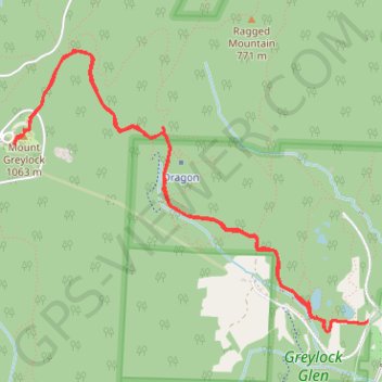
Mount Greylock
Hike to Mount Greylock via Glen Meadow Loop, Bellows Pipe Trail, Thunderbolt Ski Trail and Appalachian Trail in the Mount Greylock State Reservation and the Greylock Glen. #Hike #Mountain #Nature #Forest #Appalachian
- Distance: 5.6 mi
- Elevation gain: 2,392 ft
- Maximum elevation: 3,484 ft
- Elevation loss: 2,398 ft
- Minimum elevation: 1,155 ft
- Moving time: 3 h 23 m
- Moving speed: 1.6 mph
- Maximum speed: 3.0 mph
- Total time: 4 h 36 m
- Global speed: 1.2 mph
- Date: 07/14/2019
Interactive map
GPS track profile
About this GPS track
Name: Mount Greylock GPS track, route, trail
Coordinates: 42.62531 -73.16682 42.64248 -73.13752
Topography: Berkshire County topographic map