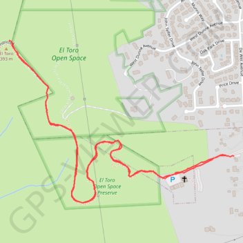
El toro church to summit and back
Hike from Morgan Hill to El Toro via West Hills Community Church and Open Space Authority Trail in the El Toro Open Space Preserve. #Hike #Nature #Forest
- Distance: 2.5 mi
- Elevation gain: 978 ft
- Maximum elevation: 1,368 ft
- Elevation loss: 991 ft
- Minimum elevation: 436 ft
- Moving time: 46 m 37 s
- Moving speed: 3.3 mph
- Maximum speed: 15.8 mph
- Total time: 49 m 35 s
- Global speed: 3.1 mph
- Date: 03/26/2024
Interactive map
GPS track profile
About this GPS track
Name: El toro church to summit and back GPS track, route, trail
Start: De Witt Avenue, Santa Clara County, California, 95038, United States (37.11640 -121.66264)
End: De Witt Avenue, Santa Clara County, California, 95038, United States (37.11636 -121.66223)
Coordinates: 37.11456 -121.67317 37.12085 -121.66223
Topography: Santa Clara County topographic map