2024-03-30_10-35_Sat
- Distance: 13.3 mi
- Elevation gain: 656 ft
- Maximum elevation: 194 ft
- Elevation loss: 663 ft
- Minimum elevation: 33 ft
Interactive map
GPS track profile
About this GPS track
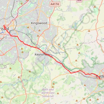
Name: 2024-03-30_10-35_Sat GPS track, route, trail
Coordinates: 51.37767 -2.59388 51.45914 -2.35878
Other GPS tracks
Click on a GPS track to view route, its statistics and profile.
TT22 Jo10 M8/06 : Aberystwyth à Cheddar
Royaume-Uni > Pays de Galles > Ceredigion > Aberystwyth
Distance: 153.7 mi • Elevation gain: 12,710 ft • Maximum elevation: 1,690 ft
Dean2023-311
United Kingdom > England > Oxfordshire > Oxford
Distance: 192.8 mi • Elevation gain: 11,043 ft • Maximum elevation: 951 ft