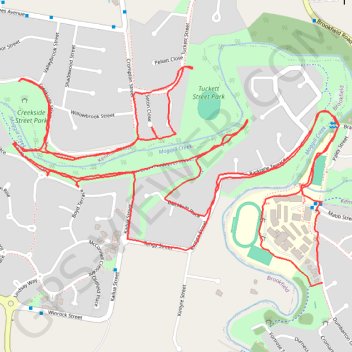
Brisbane Trail Run
- Distance: 5.5 mi
- Elevation gain: 308 ft
- Maximum elevation: 135 ft
- Elevation loss: 312 ft
- Minimum elevation: 43 ft
- Moving time: 1 h 1 m
- Moving speed: 5.4 mph
- Maximum speed: 8.7 mph
- Total time: 1 h 1 m
- Global speed: 5.4 mph
- Date: 03/29/2024
Interactive map
GPS track profile
About this GPS track
Name: Brisbane Trail Run GPS track, route, trail
Start: 62, Dumbarton Drive, Kenmore, Greater Brisbane, Queensland, 4069, Australia (-27.50973 152.92996)
End: 60, Dumbarton Drive, Kenmore, Greater Brisbane, Queensland, 4069, Australia (-27.51003 152.93006)
Coordinates: -27.51014 152.91813 -27.50260 152.93070
Other GPS tracks
Click on a GPS track to view route, its statistics and profile.