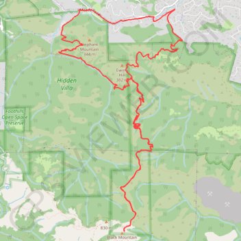
Black Mountain Loop (Rancho San Antonio Open Space Preserve)
Loop hike to Black Mountain via Rhus Ridge Trail, Black Mountain Trail, Creek Trail, Toyon Trail, Hostel Trail, Hidden Villa, Francemont Drive and Rhus Ridge Road in the Rancho San Antonio Open Space Preserve and Hidden Villa. #Hike #Loop #Mountain #Nature #Forest
- Distance: 12.3 mi
- Elevation gain: 3,576 ft
- Maximum elevation: 2,805 ft
- Elevation loss: 3,589 ft
- Minimum elevation: 400 ft
- Moving time: 3 h 25 m
- Moving speed: 3.6 mph
- Maximum speed: 6.9 mph
- Total time: 3 h 33 m
- Global speed: 3.5 mph
- Date: 01/15/2024
Interactive map
GPS track profile
About this GPS track
Name: Black Mountain Loop (Rancho San Antonio Open Space Preserve) GPS track, route, trail
Coordinates: 37.31754 -122.16109 37.35449 -122.13529
Topography: Santa Clara County topographic map