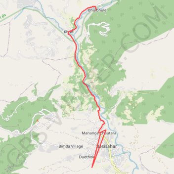
Besisahar à Bulbhule
Randonnée entre Besisahar et Bhulbhule. #Randonnée
- Distance: 7.7 mi
- Elevation gain: 1,394 ft
- Maximum elevation: 2,782 ft
- Elevation loss: 1,329 ft
- Minimum elevation: 2,369 ft
Interactive map
GPS track profile
About this GPS track
Name: Besisahar à Bulbhule GPS track, route, trail
Coordinates: 28.22200 84.35732 28.29183 84.37587
Other GPS tracks
Click on a GPS track to view route, its statistics and profile.
Tour Annapurna - Jour 01 - Besisahar - Bhulbhule
Népal > Gandaki > लमजुङ > Manange Chautara
Randonnée entre Besisahar et Bhulbhule. #Randonnée
Distance: 5.2 mi • Elevation gain: 1,033 ft • Maximum elevation: 2,746 ft