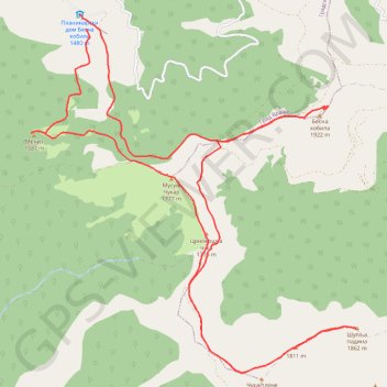
Trenutna trasa: 29 KOL 2015 09:15 001
- Distance: 12.6 mi
- Elevation gain: 3,094 ft
- Maximum elevation: 6,263 ft
- Elevation loss: 3,091 ft
- Minimum elevation: 4,767 ft
- Moving time: 4 h 53 m
- Moving speed: 2.6 mph
- Maximum speed: 4.3 mph
- Total time: 6 h 20 m
- Global speed: 2.0 mph
- Date: 08/29/2015
Interactive map
GPS track profile
About this GPS track
Name: Trenutna trasa: 29 KOL 2015 09:15 001 GPS track, route, trail
Coordinates: 42.50063 22.18665 42.54075 22.23604
Topography: Pcinja Administrative District topographic map