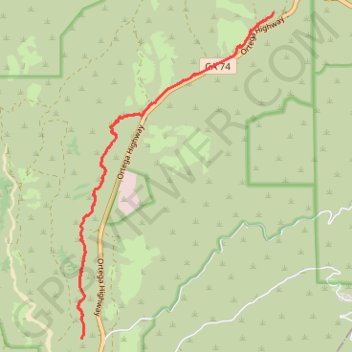
San Juan Hot Springs
Hike through Ronald W. Caspers Wilderness Park from Ortega Flats Campground to San Juan Hot Springs. #Hike #Mountain #Nature #Forest #Wilderness #Park
- Distance: 10.2 mi
- Elevation gain: 1,247 ft
- Maximum elevation: 814 ft
- Elevation loss: 1,247 ft
- Minimum elevation: 410 ft
- Moving time: 2 h 58 m
- Moving speed: 3.4 mph
- Maximum speed: 25.3 mph
- Total time: 2 h 58 m
- Global speed: 3.4 mph
- Date: 07/06/2016
Interactive map
GPS track profile
About this GPS track
Name: San Juan Hot Springs GPS track, route, trail
Start: Juaneño Trail, Orange County, California, 92085, United States (33.54052 -117.55221)
End: Juaneño Trail, Orange County, California, 92085, United States (33.54053 -117.55221)
Coordinates: 33.54052 -117.55307 33.58925 -117.51770
Topography: Orange County topographic map
Other GPS tracks
Click on a GPS track to view route, its statistics and profile.