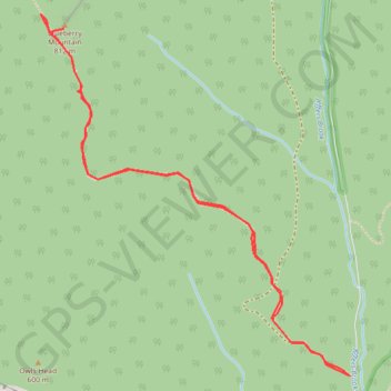
Blueberry Mountain
Hike to Blueberry Mountain via Blueberry Mountain Trail in the White Mountain National Forest. #Hike #Mountain #Forest #Nature
- Distance: 3.5 mi
- Elevation gain: 1,053 ft
- Maximum elevation: 2,631 ft
- Elevation loss: 1,050 ft
- Minimum elevation: 1,575 ft
- Moving time: 1 h 19 m
- Moving speed: 2.6 mph
- Maximum speed: 4.0 mph
- Total time: 1 h 19 m
- Global speed: 2.6 mph
- Date: 10/02/2023
Interactive map
GPS track profile
About this GPS track
Name: Blueberry Mountain GPS track, route, trail
Coordinates: 44.00485 -71.90638 44.01983 -71.88859
Topography: Grafton County topographic map
Other GPS tracks
Click on a GPS track to view route, its statistics and profile.