Kings Park Loop
- Distance: 3.0 mi
- Elevation gain: 167 ft
- Maximum elevation: 233 ft
- Elevation loss: 174 ft
- Minimum elevation: 95 ft
Interactive map
GPS track profile
About this GPS track
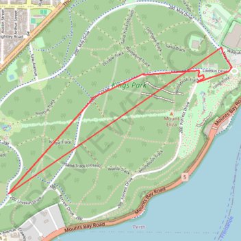
Name: Kings Park Loop GPS track, route, trail
Start: May Drive, Kings Park, Western Australia, 6005, Australia (-31.96045 115.84113)
End: May Drive, Kings Park, Western Australia, 6005, Australia (-31.96085 115.84140)
Coordinates: -31.97013 115.82222 -31.95944 115.84148
Topography: Kings Park topographic map
Other GPS tracks
Click on a GPS track to view route, its statistics and profile.
2021 Toodyay return via Kep
Distance: 142.9 mi • Elevation gain: 6,099 ft • Maximum elevation: 1,171 ft