RE SK350770 3
- Distance: 6.0 mi
- Elevation gain: 312 ft
- Maximum elevation: 640 ft
- Elevation loss: 292 ft
- Minimum elevation: 505 ft
Interactive map
GPS track profile
About this GPS track
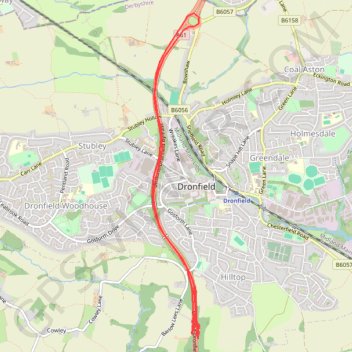
Name: RE SK350770 3 GPS track, route, trail
Coordinates: 53.28848 -1.48174 53.31727 -1.47472
Other GPS tracks
Click on a GPS track to view route, its statistics and profile.
RE SK350770
United Kingdom > England > Derbyshire > North East Derbyshire > Dronfield
Distance: 0.9 mi • Elevation gain: 46 ft • Maximum elevation: 646 ft