Alyth to Spittal of Glenshee - Cateran Trail (some of)
- Distance: 27.4 mi
- Elevation gain: 3,720 ft
- Maximum elevation: 2,133 ft
- Elevation loss: 2,949 ft
- Minimum elevation: 325 ft
- Moving time: 4 h 3 m
- Moving speed: 6.8 mph
- Maximum speed: 26.9 mph
- Total time: 4 h 41 m
- Global speed: 5.9 mph
- Date: 05/04/2024
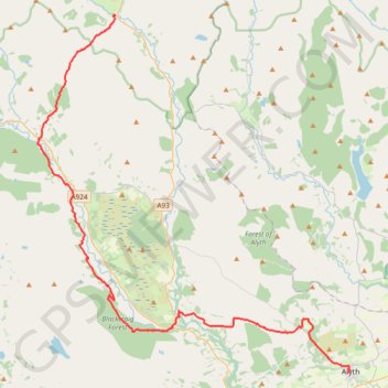
Interactive map
GPS track profile
About this GPS track
Name: Alyth to Spittal of Glenshee - Cateran Trail (some of) GPS track, route, trail
Start: Albert Street, Alyth, Perth and Kinross, Scotland, PH11 8AA, United Kingdom (56.62128 -3.23327)
End: Spittal of Glenshee, Perth and Kinross, Scotland, PH10 7QE, United Kingdom (56.81373 -3.46002)
Coordinates: 56.62128 -3.53599 56.81403 -3.23014
Other GPS tracks
Click on a GPS track to view route, its statistics and profile.
Spittal of Glenshee to Alyth - Some of the Cateran Trail
United Kingdom > Scotland > Perth and Kinross > Spittal of Glenshee
Distance: 23.8 mi • Elevation gain: 1,841 ft • Maximum elevation: 1,506 ft
Around Kirkmichael, Perthshire
United Kingdom > Scotland > Perth and Kinross > Kirkmichael
Distance: 4.8 mi • Elevation gain: 289 ft • Maximum elevation: 899 ft
Around Bridge of Cally
United Kingdom > Scotland > Perth and Kinross > Bridge of Cally > Netherton
Distance: 8.3 mi • Elevation gain: 925 ft • Maximum elevation: 961 ft
EMTB Gravel: Auchintaple Loch Loop
United Kingdom > Scotland > Angus > Folda > Little Forter
Around Auchintaple Loch, nr Folda, Angus
Distance: 9.7 mi • Elevation gain: 1,293 ft • Maximum elevation: 1,499 ft