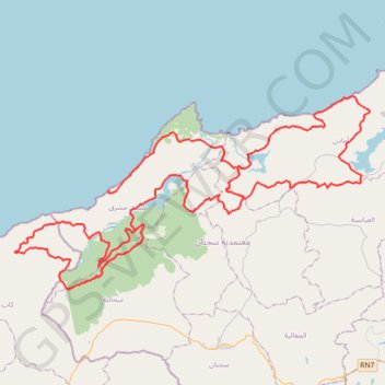
Endurance Ultra Trail Challenge 140K
- Distance: 87.8 mi
- Elevation gain: 9,091 ft
- Maximum elevation: 1,381 ft
- Elevation loss: 8,698 ft
- Minimum elevation: 0 ft
- Moving time: 1 d 11 h
- Moving speed: 2.5 mph
- Maximum speed: 12.6 mph
- Total time: 1 d 11 h
- Global speed: 2.4 mph
- Date: 12/31/1999
Interactive map
GPS track profile
About this GPS track
Name: Endurance Ultra Trail Challenge 140K GPS track, route, trail
End: Tamra, Sidi Mechreg, Délégation Sejnane, Gouvernorat Bizerte, Tunisie (37.10092 9.09760)
Coordinates: 37.10042 9.04895 37.24538 9.38213