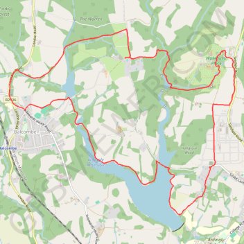
Ardingly Reservoir Loop
Loop hike via Balcombe, Braky Wood, Balcombe Lake, Ardingly Reservoir, Ardingly, Wakehurst Place, Mansion Pond, Westwood Lake and The Warren in the High Weald National Landscape. #Hike #Loop #Lake #Nature #Forest #Countryside
- Distance: 9.2 mi
- Elevation gain: 761 ft
- Maximum elevation: 463 ft
- Elevation loss: 758 ft
- Minimum elevation: 180 ft
- Moving time: 3 h 5 m
- Moving speed: 3.0 mph
- Maximum speed: 4.2 mph
- Total time: 4 h 24 m
- Global speed: 2.1 mph
- Date: 03/20/2024
Interactive map
GPS track profile
About this GPS track
Name: Ardingly Reservoir Loop GPS track, route, trail
Coordinates: 51.04515 -0.13664 51.07216 -0.08433
Other GPS tracks
Click on a GPS track to view route, its statistics and profile.
French Divide
France > Hauts-de-France > Nord > Bray-Dunes
Traversez la France du nord au sud sur 2200 Km de sentiers, chemins et petites routes... Magique ! Vous connaissez la mythique Great Divide ? La French Divide est elle aussi en train de devenir une grande classique des traversées en bikepacking et sans assistance !
Distance: 1,376.9 mi • Elevation gain: 110,164 ft • Maximum elevation: 4,754 ft
Newhaven Londres
Royaume-Uni > Angleterre > Cité de Londres
Vélo. En aller simple entre Londres et Newhaven. #Vélo
Distance: 96.7 mi • Elevation gain: 3,737 ft • Maximum elevation: 663 ft
Balcombe to Staplefield Loop
United Kingdom > England > West Sussex > Mid Sussex > Balcombe
Loop hike from Balcombe to Staplefield via Balcombe Recreation Ground, Kemps Farm, Whitethroat Lane, Brantridge Lane, Tanyard Lane, Ditton Place and Westup Road in the High Weald National Landscape. #Hike #Loop #Countryside #Nature #Forest
Distance: 7.7 mi • Elevation gain: 823 ft • Maximum elevation: 463 ft