Kademliisko praskalo
- Distance: 17.8 mi
- Elevation gain: 5,627 ft
- Maximum elevation: 4,600 ft
- Elevation loss: 4,216 ft
- Minimum elevation: 1,923 ft
- Moving time: 5 h 32 m
- Moving speed: 3.2 mph
- Maximum speed: 11.4 mph
- Total time: 6 h 29 m
- Global speed: 2.7 mph
Interactive map
GPS track profile
About this GPS track
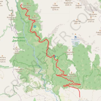
Name: Kademliisko praskalo GPS track, route, trail
End: с. Тъжа - х. Тъжа, Tazha, Pavel Bania, Stara Zagora, 6160, Bulgaria (42.67992 25.06196)
Coordinates: 42.66060 25.02286 42.72740 25.08134
Other GPS tracks
Click on a GPS track to view its route, statistics and profile.
Tour d'Europe
France > Bretagne > Finistère > Concarneau > Landan Creis
Distance: 4,432.2 mi • Elevation gain: 146,335 ft • Maximum elevation: 7,982 ft