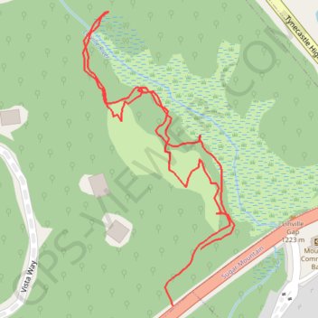
Linville Gap trail
- Distance: 0.9 mi
- Elevation gain: 89 ft
- Maximum elevation: 4,058 ft
- Elevation loss: 85 ft
- Minimum elevation: 4,006 ft
- Moving time: 23 m 25 s
- Moving speed: 2.2 mph
- Maximum speed: 10.4 mph
- Total time: 32 m 6 s
- Global speed: 1.6 mph
Interactive map
GPS track profile
About this GPS track
Name: Linville Gap trail GPS track, route, trail
Coordinates: 36.11675 -81.84428 36.12054 -81.84187
Topography: Avery County topographic map, elevation, terrain