Fairyland Loop Trail
Interactive map
GPS track profile
About this GPS track
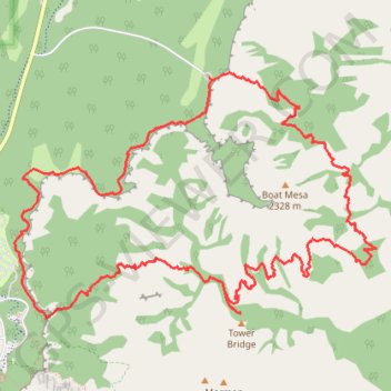
Name: Fairyland Loop Trail GPS track, route, trail
Coordinates: 37.63194 -112.16550 37.64981 -112.13232
Topography: Garfield County topographic map
Other GPS tracks
Click on a GPS track to view route, its statistics and profile.
Bryce Canyon National Park Peek-a-Boo Loop
United States > Utah > Garfield County
BCNP
Distance: 15.9 mi • Elevation gain: 2,740 ft • Maximum elevation: 8,330 ft