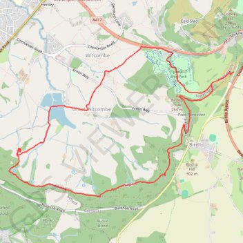
Witcombe Loop
Loop hike around Great Witcombe from Barrow Wake via Viner's Plantation, Birdlip Peak, Peak Plantation, Witcombe Wood, Great Witcombe Roman Villa, Witcombe Reservoirs and Flyup 417 Bike Park. #Hike #Loop #Nature #Forest #Lake
- Distance: 6.9 mi
- Elevation gain: 1,112 ft
- Maximum elevation: 902 ft
- Elevation loss: 984 ft
- Minimum elevation: 282 ft
- Moving time: 2 h 28 m
- Moving speed: 2.8 mph
- Maximum speed: 10.9 mph
- Total time: 3 h 23 m
- Global speed: 2.0 mph
- Date: 03/24/2024
Interactive map
GPS track profile
About this GPS track
Name: Witcombe Loop GPS track, route, trail
Coordinates: 51.82077 -2.14995 51.84101 -2.10080
Other GPS tracks
Click on a GPS track to view route, its statistics and profile.
Dean2023-311
United Kingdom > England > Oxfordshire > Oxford
Distance: 192.8 mi • Elevation gain: 11,043 ft • Maximum elevation: 951 ft