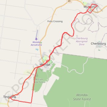
Tinny-Murgon
Rail trail and roads Tingoora to Murgon
- Distance: 31.5 mi
- Elevation gain: 1,352 ft
- Maximum elevation: 1,358 ft
- Elevation loss: 1,352 ft
- Minimum elevation: 915 ft
- Moving time: 2 h 40 m
- Moving speed: 11.8 mph
- Maximum speed: 32.7 mph
- Total time: 3 h 17 m
- Global speed: 9.6 mph
- Date: 03/31/2024
Interactive map
GPS track profile
About this GPS track
Name: Tinny-Murgon GPS track, route, trail
Coordinates: -26.37068 151.82098 -26.23740 151.95277
Other GPS tracks
Click on a GPS track to view route, its statistics and profile.
Murgon - Kingaroy
Australia > Queensland > Murgon
#Bike
Distance: 30.1 mi • Elevation gain: 1,099 ft • Maximum elevation: 1,604 ft