Teezt
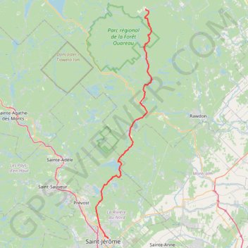
- Distance: 45.0 mi
- Elevation gain: 4,711 ft
- Maximum elevation: 1,962 ft
- Elevation loss: 3,993 ft
- Minimum elevation: 299 ft
Interactive map
GPS track profile
About this GPS track
Name: Teezt GPS track, route, trail
End: Rue des Skieurs, Saint-Côme, Matawinie, Lanaudière, Québec, Canada (46.27163 -73.87055)
Coordinates: 45.78246 -74.02477 46.27163 -73.85187
Other GPS tracks
Click on a GPS track to view route, its statistics and profile.