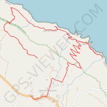
Trail Planner Map
- Distance: 5.8 mi
- Elevation gain: 2,116 ft
- Maximum elevation: 1,565 ft
- Elevation loss: 1,959 ft
- Minimum elevation: 16 ft
Interactive map
GPS track profile
About this GPS track
Name: Trail Planner Map GPS track, route, trail
Start: Fajã da Penedia, Norte Pequeno, Calheta, Açores, 9850-076, Portugal (38.65323 -28.00409)
End: ER 1-2, Norte Pequeno, Calheta, Açores, 9850-076, Portugal (38.64602 -28.00587)
Coordinates: 38.64538 -28.01229 38.66292 -27.98806