Trail Planner Map
- Distance: 4.2 mi
- Elevation gain: 1,378 ft
- Maximum elevation: 2,556 ft
- Elevation loss: 1,378 ft
- Minimum elevation: 1,178 ft
Interactive map
GPS track profile
About this GPS track
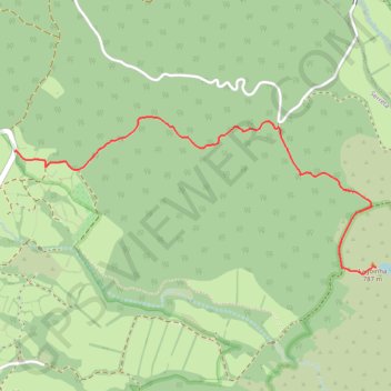
Name: Trail Planner Map GPS track, route, trail
End: Terreiro, Serreta, Angra do Heroísmo, Açores, 9700-661, Portugal (38.75552 -27.35514)
Coordinates: 38.74930 -27.35514 38.75727 -27.33168
Other GPS tracks
Click on a GPS track to view route, its statistics and profile.
Grande Rota do Oeste - BTT (Ilha Terceira)
Distance: 38.1 mi • Elevation gain: 6,421 ft • Maximum elevation: 2,556 ft