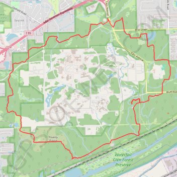
Waterfall Glenn Forest Loop
Loop hike around the Waterfall Glenn Forest Preserve via Waterfall Glenn Main Trail, Des Plaines River Scenic Overlook and Sawmill Creek Waterfall. #Hike #Loop #Forest #Nature #Fall #River #Park
- Distance: 10.0 mi
- Elevation gain: 338 ft
- Maximum elevation: 764 ft
- Elevation loss: 338 ft
- Minimum elevation: 600 ft
- Moving time: 3 h 22 m
- Moving speed: 3.0 mph
- Maximum speed: 3.9 mph
- Total time: 3 h 37 m
- Global speed: 2.8 mph
- Date: 10/29/2018
Interactive map
GPS track profile
About this GPS track
Name: Waterfall Glenn Forest Loop GPS track, route, trail
Start: South Frontage Road, Darien, DuPage County, Illinois, 60561, United States (41.72553 -87.97235)
End: South Frontage Road, Darien, DuPage County, Illinois, 60561, United States (41.72528 -87.97224)
Coordinates: 41.69293 -88.00369 41.72566 -87.95294
Topography: DuPage County topographic map