Hoyt Mountain Loop
Loop hike from Georges Gap to Hoyt Mountain via Clear Creek Vista, Firebreak, Tank Saddle, Telephone Trail and World of Chaparral Trail in the Angeles National Forest. #Hike #Loop #Mountain #Nature #Forest #Angeles
- Distance: 3.5 mi
- Elevation gain: 1,594 ft
- Maximum elevation: 4,377 ft
- Elevation loss: 1,594 ft
- Minimum elevation: 3,163 ft
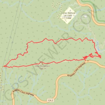
Interactive map
GPS track profile
About this GPS track
Name: Hoyt Mountain Loop GPS track, route, trail
Start: World Of Chaparral Trail, Los Angeles County, California, United States (34.26975 -118.16840)
End: World Of Chaparral Trail, Los Angeles County, California, United States (34.26974 -118.16841)
Coordinates: 34.26868 -118.18459 34.27356 -118.16518
Topography: Los Angeles County topographic map