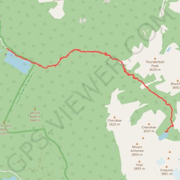
Crater Lake
Hike from Monarch Lake to Crater Lake via Cascade Creek Trail in the Indian Peaks Wilderness. #Hike #Mountain #Lake #River #Nature #Wilderness
- Distance: 15.5 mi
- Elevation gain: 2,753 ft
- Maximum elevation: 10,400 ft
- Elevation loss: 2,753 ft
- Minimum elevation: 8,356 ft
- Moving time: 6 h 28 m
- Moving speed: 2.4 mph
- Maximum speed: 3.9 mph
- Total time: 7 h 4 m
- Global speed: 2.2 mph
- Date: 07/12/2008
Interactive map
GPS track profile
About this GPS track
Name: Crater Lake GPS track, route, trail
Start: Monarch Lake Trailhead, CR 6, Grand County, Colorado, United States (40.11166 -105.74776)
End: Monarch Lake Trailhead, CR 6, Grand County, Colorado, United States (40.11170 -105.74781)
Coordinates: 40.07742 -105.74781 40.11170 -105.65867
Topography: Grand County topographic map
Other GPS tracks
Click on a GPS track to view route, its statistics and profile.
Lone Eagle Peak - Pawnee Pass
United States > Colorado > Grand County
Lake Ganby, Monarch Lake, Crater Lake, Triangle Lake, Pawnee Lake, Lake Isabelle, Long Lake. Rocky Mountains. #Hike #RockyMountains
Distance: 20.4 mi • Elevation gain: 6,581 ft • Maximum elevation: 12,546 ft