Tracked with OSMTracker for Android™
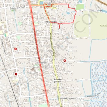
Kalarcode MDR ride
- Distance: 3.8 mi
- Elevation gain: 30 ft
- Maximum elevation: 36 ft
- Elevation loss: 33 ft
- Minimum elevation: 13 ft
- Moving time: 16 m 33 s
- Moving speed: 13.8 mph
- Maximum speed: 27.8 mph
- Total time: 21 m 8 s
- Global speed: 10.8 mph
- Date: 02/10/2024
Interactive map
GPS track profile
About this GPS track
Name: Tracked with OSMTracker for Android™ GPS track, route, trail
Coordinates: 9.44226 76.33926 9.46662 76.35055
Other GPS tracks
Click on a GPS track to view route, its statistics and profile.
20240210100212
India > Kerala > Ambalappuzha > Paravoor
Distance: 3.5 mi • Elevation gain: 36 ft • Maximum elevation: 36 ft