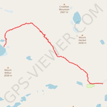
Iceberg Lake (Glacier National Park)
Hike to Iceberg Lake via Ptarmigan Trail and Iceberg Lake Trail in the Glacier National Park. #Hike #Mountain #Lake #Nature #Forest #Park
- Distance: 10.7 mi
- Elevation gain: 1,844 ft
- Maximum elevation: 6,152 ft
- Elevation loss: 1,857 ft
- Minimum elevation: 4,898 ft
- Moving time: 3 h 57 m
- Moving speed: 2.7 mph
- Maximum speed: 21.4 mph
- Total time: 6 h 26 s
- Global speed: 1.8 mph
- Date: 08/07/2016
Interactive map
GPS track profile
About this GPS track
Name: Iceberg Lake (Glacier National Park) GPS track, route, trail
Start: 1498, Many Glacier Road, Glacier County, Montana, 59417, United States (48.79760 -113.67450)
End: Many Glacier Road, Glacier County, Montana, United States (48.79766 -113.66796)
Coordinates: 48.79742 -113.74223 48.82753 -113.66796
Topography: Glacier County topographic map