Insta360 GPS Data
- Distance: 0.2 mi
- Elevation gain: 174 ft
- Maximum elevation: 837 ft
- Elevation loss: 0 ft
- Minimum elevation: 663 ft
- Moving time: 4 m 18 s
- Moving speed: 3.1 mph
- Maximum speed: 4.9 mph
- Total time: 4 m 18 s
- Global speed: 3.1 mph
- Date: 07/14/2023
Interactive map
GPS track profile
About this GPS track
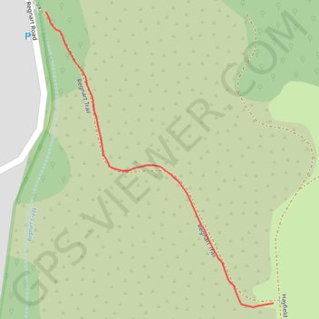
Name: Insta360 GPS Data GPS track, route, trail
Coordinates: 37.29074 -122.06231 37.29301 -122.06011
Topography: Cupertino topographic map