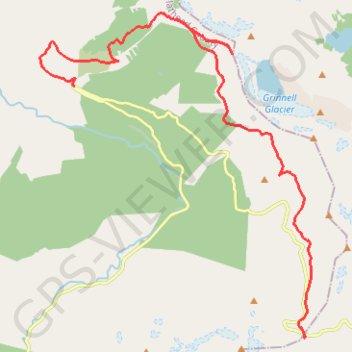
Highline Trail and Grinnell Glacier Overlook
Hike from Logan Pass to Grinnell Glacier Overlook via Highline Trail, Haystack Pass, Garden Wall Trail and Granite Park Trail in the Glacier National Park. #Hike #Mountain #Nature #Glacier #Overlook #Park
- Distance: 14.1 mi
- Elevation gain: 3,399 ft
- Maximum elevation: 7,562 ft
- Elevation loss: 5,735 ft
- Minimum elevation: 4,268 ft
- Moving time: 5 h 57 m
- Moving speed: 2.4 mph
- Maximum speed: 4.7 mph
- Total time: 6 h 29 m
- Global speed: 2.2 mph
- Date: 08/09/2016
Interactive map
GPS track profile
About this GPS track
Name: Highline Trail and Grinnell Glacier Overlook GPS track, route, trail
Start: Going-to-the-Sun Road, Flathead County, Montana, United States (48.69652 -113.71815)
End: Going-to-the-Sun Road, Flathead County, Montana, United States (48.75466 -113.79977)
Coordinates: 48.69528 -113.81218 48.77192 -113.71538
Topography: Flathead County topographic map
Other GPS tracks
Click on a GPS track to view route, its statistics and profile.