Northfield Trail Running
Northfield Mountain Yellow
- Distance: 4.9 mi
- Elevation gain: 666 ft
- Maximum elevation: 955 ft
- Elevation loss: 666 ft
- Minimum elevation: 417 ft
- Moving time: 1 h 1 m
- Moving speed: 4.8 mph
- Maximum speed: 9.6 mph
- Total time: 1 h 13 m
- Global speed: 4.0 mph
- Date: 03/31/2024
Interactive map
GPS track profile
About this GPS track
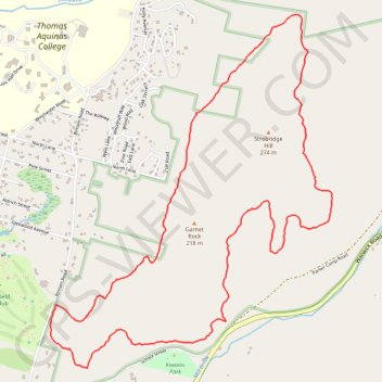
Name: Northfield Trail Running GPS track, route, trail
Coordinates: 42.69761 -72.44232 42.71714 -72.42110
Topography: Franklin County topographic map