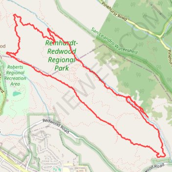
Redwood Regional Park Loop
Loop hike from Canyon Meadow via Stream Trail, Redwood Creek, French Trail, Mardrone Trail, West Ridge Trail and Bridle Trail in the Reinhardt-Redwood Regional Park. #Hike #Loop #Mountain #Forest #Nature #Park #River
- Distance: 6.3 mi
- Elevation gain: 1,394 ft
- Maximum elevation: 1,526 ft
- Elevation loss: 1,394 ft
- Minimum elevation: 571 ft
- Moving time: 2 h 36 m
- Moving speed: 2.4 mph
- Maximum speed: 5.5 mph
- Total time: 3 h 6 m
- Global speed: 2.0 mph
- Date: 05/05/2014
Interactive map
GPS track profile
About this GPS track
Name: Redwood Regional Park Loop GPS track, route, trail
Start: Stream Trail, Alameda, Alameda County, California, 94516, United States (37.80706 -122.14888)
Coordinates: 37.80117 -122.17450 37.82169 -122.14553
Topography: Alameda topographic map