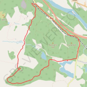
Birnam Robin's Dam Loop
Loop MTB / gravel / hike from Birnam to Robin's Dam via Stair Bridge Viewpoint and Stare Dam - Rohallion Loch. #MTB #Gravel #Hike #Loop #Forest #Nature #Lake #Dam #River
- Distance: 4.6 mi
- Elevation gain: 807 ft
- Maximum elevation: 1,007 ft
- Elevation loss: 810 ft
- Minimum elevation: 262 ft
- Moving time: 58 m 44 s
- Moving speed: 4.7 mph
- Maximum speed: 20.4 mph
- Total time: 1 h 8 m
- Global speed: 4.0 mph
- Date: 02/16/2024
Interactive map
GPS track profile
About this GPS track
Name: Birnam Robin's Dam Loop GPS track, route, trail
Start: B867, Dunkeld, Perth and Kinross, Scotland, PH8 0DW, United Kingdom (56.54624 -3.56081)
End: B867, Dunkeld, Perth and Kinross, Scotland, PH8 0DW, United Kingdom (56.54629 -3.56102)
Coordinates: 56.52634 -3.57382 56.54651 -3.54095