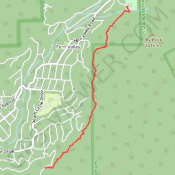
Ernie Maxwell Scenic Trail
Hike from Idyllwild to Humber Park via Ernie Maxwell Trail in San Bernardino National Forest. #Hike #Nature #Forest #Mountain
- Distance: 2.3 mi
- Elevation gain: 935 ft
- Maximum elevation: 6,450 ft
- Elevation loss: 272 ft
- Minimum elevation: 5,761 ft
- Moving time: 22 m 23 s
- Moving speed: 6.3 mph
- Maximum speed: 7.2 mph
- Total time: 22 m 23 s
- Global speed: 6.3 mph
- Date: 12/31/2009
Interactive map
GPS track profile
About this GPS track
Name: Ernie Maxwell Scenic Trail GPS track, route, trail
Coordinates: 33.74036 -116.70229 33.76468 -116.68696
Topography: Riverside County topographic map
Other GPS tracks
Click on a GPS track to view route, its statistics and profile.
Suicide Rock
United States > California > Riverside County > Idyllwild-Pine Cove
Hike to Suicide Rock by the Deer Springs Trail and the Suicide Rock Trail in the San Bernardino National Forest and the Mount San Jacinto State Wilderness. #Hike #Mountain #Nature #Forest #Wilderness
Distance: 3.4 mi • Elevation gain: 1,864 ft • Maximum elevation: 7,431 ft
Mount Jacinto Loop
United States > California > Riverside County > Idyllwild-Pine Cove
Loop Hike to Mount Jacinto via Deer Springs Trail, Pacific Crest Trail (PCT), Peak Trail and Wellman's Cienaga Trail in the San Bernardino National Forest and the Mount San Jacinto State Park. #Hike #Loop #Mountain #Nature #Forest #Park #PCT
Distance: 17.4 mi • Elevation gain: 5,400 ft • Maximum elevation: 10,758 ft
Suicide Rock
United States > California > Riverside County > Idyllwild-Pine Cove
Hike from Idyllwild Nature Center to Suicide Rock via Deer Springs Trail and Suicide Rock Trail in the San Bernardino National Forest and the Mount San Jacinto State Wilderness. #Hike #Mountain #Nature #Forest #Wilderness
Distance: 7.5 mi • Elevation gain: 2,093 ft • Maximum elevation: 7,421 ft
Pacific Crest Trail (PCT) through San Bernardino Forest and Santa Rosa and San Jacinto Mountains
United States > California > Riverside County
Hike from Bull Canyon Parking to Snow Creek along the Pacific Crest National Scenic Trail via Lion Peak, Pyramid Peak, Cedar Spring, Palm View Peak, Fobes Saddle, Spitler Peak, Apache Peak, Apache Spring, Antsell Rock, South Peak, Red Tahquitz, Tahquitz Meadow, Powderbox Spring, Middle Spring, Jolley Spring, Idylwild, Deer Springs…
Distance: 59.0 mi • Elevation gain: 13,064 ft • Maximum elevation: 8,980 ft