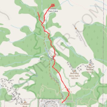
Soldier Pass Cave
Hike from Sedona to Soldier Pass Cave via Soldier Pass Trail and Seven Sacred Pools in the Red Rock-Secret Mountain Wilderness and the Coconino National Forest. #Hike #Cave #Nature #Rock #Forest
- Distance: 3.3 mi
- Elevation gain: 630 ft
- Maximum elevation: 4,925 ft
- Elevation loss: 630 ft
- Minimum elevation: 4,449 ft
Interactive map
GPS track profile
About this GPS track
Name: Soldier Pass Cave GPS track, route, trail
Start: Soldier Pass Trail, Sedona, Yavapai County, Arizona, 86336, United States (34.88424 -111.78391)
End: Soldier Pass Road, Sedona, Yavapai County, Arizona, 86336, United States (34.88426 -111.78386)
Coordinates: 34.88424 -111.78886 34.90100 -111.78236
Topography: Yavapai County topographic map
Other GPS tracks
Click on a GPS track to view route, its statistics and profile.