Griffith Park
Morning Hike
- Distance: 3.5 mi
- Elevation gain: 758 ft
- Maximum elevation: 1,066 ft
- Elevation loss: 761 ft
- Minimum elevation: 453 ft
- Moving time: 1 h 14 m
- Moving speed: 2.8 mph
- Maximum speed: 4.5 mph
- Total time: 1 h 24 m
- Global speed: 2.5 mph
- Date: 04/25/2024
Interactive map
GPS track profile
About this GPS track
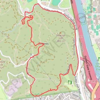
Name: Griffith Park GPS track, route, trail
Coordinates: 34.11926 -118.28417 34.13266 -118.27424
Topography: Los Angeles topographic map