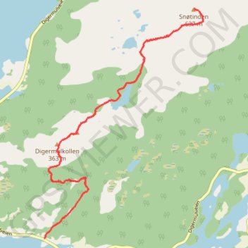
Digermulen - Keiservarden - Snøtind 003
- Distance: 6.0 mi
- Elevation gain: 2,621 ft
- Maximum elevation: 2,077 ft
- Elevation loss: 2,621 ft
- Minimum elevation: 52 ft
Interactive map
GPS track profile
About this GPS track
Name: Digermulen - Keiservarden - Snøtind 003 GPS track, route, trail
Start: Keisermarsjen, Elvebakken, Vågan, Nordland, 8324, Norvège (68.30422 15.01064)
End: Keisermarsjen, Elvebakken, Vågan, Nordland, 8324, Norvège (68.30422 15.01064)
Coordinates: 68.30422 15.01064 68.32798 15.05508
Other GPS tracks
Click on a GPS track to view route, its statistics and profile.
Stage 1: Arctic Ocean to Väylä — European Divide Trail
Distance: 1,730.5 mi • Elevation gain: 78,159 ft • Maximum elevation: 2,369 ft