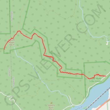
Mount Hayes
Hike from Androscoggin River to Mount Hayes via Centennial Trail and Mahoosuc Trail in the White Mountain National Forest. #Hike #Mountain #Forest #Nature #River
- Distance: 6.7 mi
- Elevation gain: 2,044 ft
- Maximum elevation: 2,562 ft
- Elevation loss: 2,047 ft
- Minimum elevation: 778 ft
- Moving time: 3 h 10 m
- Moving speed: 2.1 mph
- Maximum speed: 3.2 mph
- Total time: 3 h 50 m
- Global speed: 1.8 mph
- Date: 08/12/2023
Interactive map
GPS track profile
About this GPS track
Name: Mount Hayes GPS track, route, trail
Coordinates: 44.40315 -71.16341 44.41777 -71.12007
Topography: Coos County topographic map