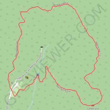
Hike on Cardwell Mountain (Apple Brandy Trail)
Apple Brandy Trail
- Distance: 2.5 mi
- Elevation gain: 374 ft
- Maximum elevation: 1,339 ft
- Elevation loss: 374 ft
- Minimum elevation: 984 ft
- Moving time: 55 m 42 s
- Moving speed: 2.7 mph
- Maximum speed: 4.7 mph
- Total time: 1 h 2 m
- Global speed: 2.4 mph
Interactive map
GPS track profile
About this GPS track
Name: Hike on Cardwell Mountain (Apple Brandy Trail) GPS track, route, trail
Coordinates: 35.66404 -85.68461 35.67269 -85.67475
Topography: Warren County topographic map, elevation, terrain
Other GPS tracks
Click on a GPS track to view its route, statistics and profile.
Gmaps Pedometer Route
United States > Kentucky > Fulton County > Hickman
Distance: 312.5 mi • Elevation gain: 13,793 ft • Maximum elevation: 1,942 ft