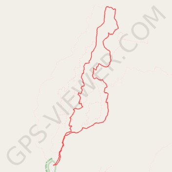
Ladder Canyon and Painted Canyon Loop
Loop hike through Ladder Canyon and Painted Canyon in the Mecca Hills Wilderness. #Hike #Loop #Canyon #Mountain #Nature #Wilderness #Desert
- Distance: 4.6 mi
- Elevation gain: 1,073 ft
- Maximum elevation: 1,335 ft
- Elevation loss: 1,076 ft
- Minimum elevation: 610 ft
- Moving time: 4 h 25 m
- Moving speed: 1.0 mph
- Maximum speed: 2.1 mph
- Total time: 13 h 1 m
- Global speed: 0.4 mph
- Date: 05/12/2012
Interactive map
GPS track profile
About this GPS track
Name: Ladder Canyon and Painted Canyon Loop GPS track, route, trail
Start: Painted Canyon Road, Riverside County, California, 92254, United States (33.61912 -115.99921)
End: Painted Canyon Road, Riverside County, California, 92254, United States (33.61916 -115.99924)
Coordinates: 33.61912 -115.99924 33.64153 -115.98824
Topography: Riverside County topographic map
Other GPS tracks
Click on a GPS track to view route, its statistics and profile.