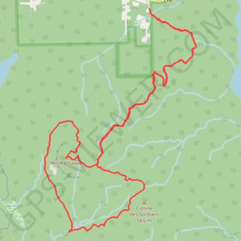
Mont Chauve par le ruisseau David
Parc national du Mont-Orford. #Randonnée #Raquettes #Boucle #MontOrford
- Distance: 8.0 mi
- Elevation gain: 1,778 ft
- Maximum elevation: 1,926 ft
- Elevation loss: 1,778 ft
- Minimum elevation: 1,010 ft
Interactive map
GPS track profile
About this GPS track
Name: Mont Chauve par le ruisseau David GPS track, route, trail
Start: Sentier de l'Érablière, Orford, Memphrémagog, Estrie, Québec, J1X 6L3, Canada (45.38736 -72.19740)
End: Sentier de l'Érablière, Orford, Memphrémagog, Estrie, Québec, J1X 6L3, Canada (45.38736 -72.19740)
Coordinates: 45.36107 -72.21492 45.38736 -72.18946
Other GPS tracks
Click on a GPS track to view route, its statistics and profile.