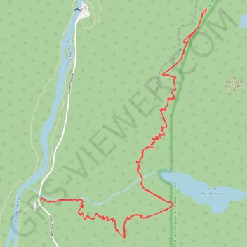
Acropole des draveurs
Randonnée en aller-retour depuis Notre-Dame-des-Monts. #Randonnée
- Distance: 6.7 mi
- Elevation gain: 3,392 ft
- Maximum elevation: 3,412 ft
- Elevation loss: 3,396 ft
- Minimum elevation: 853 ft
- Moving time: 4 h 17 m
- Moving speed: 1.6 mph
- Maximum speed: 4.1 mph
- Total time: 4 h 50 m
- Global speed: 1.4 mph
- Date: 06/26/2010
Interactive map
GPS track profile
About this GPS track
Name: Acropole des draveurs GPS track, route, trail
Coordinates: 47.87355 -70.48131 47.89210 -70.46120
Other GPS tracks
Click on a GPS track to view route, its statistics and profile.
Acropole des draveurs
Canada > Québec > Charlevoix-Est > Mont-Élie
Distance: 6.7 mi • Elevation gain: 3,392 ft • Maximum elevation: 3,412 ft