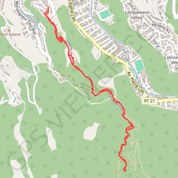
TAHITI - PEDESTRE - Papeete - La mission
Randonnée en aller-retour depuis Papeete. #Randonnée
- Distance: 3.5 mi
- Elevation gain: 1,188 ft
- Maximum elevation: 951 ft
- Elevation loss: 1,191 ft
- Minimum elevation: 381 ft
Interactive map
GPS track profile
About this GPS track
Name: TAHITI - PEDESTRE - Papeete - La mission GPS track, route, trail
Coordinates: -17.56452 -149.55634 -17.54826 -149.54710
Other GPS tracks
Click on a GPS track to view route, its statistics and profile.
TAHITI - PEDESTRE - Pirae - le belvédère
France > Polynésie française > Îles du Vent > Pīraʻe
Randonnée pédestre. Depuis Papeete. #Randonnée
Distance: 5.7 mi • Elevation gain: 1,348 ft • Maximum elevation: 2,129 ft