Import a GPX file

The Cambourne Loop

Garigal National Park. #Hike #Loop #Garigal

  • Distance: 2.8 mi
  • Elevation gain: 456 ft
  • Maximum elevation: 443 ft
  • Elevation loss: 427 ft
  • Minimum elevation: 121 ft
  • Moving time: 1 h 14 m
  • Moving speed: 2.2 mph
  • Maximum speed: 5.4 mph
  • Total time: 1 h 22 m
  • Global speed: 2.0 mph
  • Date: 01/10/2020

Interactive map

GPS track profile

About this GPS track
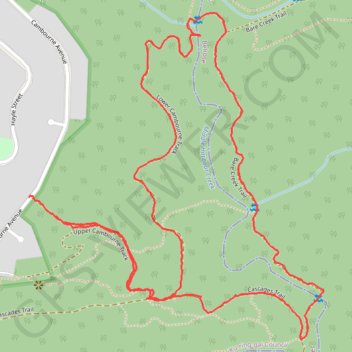
Other GPS tracks

Click on a GPS track to view route, its statistics and profile.

Ettalong

Australia > New South Wales > Sydney

Bike loop from St Ives. Ku-ring-gai Chase National Park. Brisbane Water National Park. Garigal National Park. #Bike #Loop

Distance: 83.3 mi • Elevation gain: 7,021 ft • Maximum elevation: 748 ft